Search This Blog

Wednesday, July 3, 2019

Tell Mutubis (Kom el Ahmar) | Egypt Exploration Society


https://www.ees.ac.uk/tell-mutubis

Tell Mutubis (Kom el Ahmar)

SCA 090175

The site of Tell Mutubis is located 1km east of the Rosetta Branch of the Nile, near the modern city of Metoubes and north of Disuk and Foua. The site covers an area of approximately 650 by 550 m and consists of a flat area with a mound covering the north-east part. The mound is a squat four-sided hill of about 280 m in length and 180 m wide, with a flat top which is 12m above the local ground level at its highest point.

The Delta Survey Project of the Egypt Exploration Society surveyed the mound initially in 1990, 2000-1, then again in 2012-14 and carried out drill augers around the area of the site in order to reconstruct the ancient landscapes. A full topographical survey completed a map of the site, a magnetic survey and GPR test area highlighted significant areas of disturbance and some sub-surface features and an extensive pottery survey enabled a corpus of surface material to be established for the whole site.

Red brick tank with related features at edge of mound in 2014. (Photo by Penny Wilson).

The mound has several areas of large walls in the sections on the western and southern sides. The walls are made of mud brick with an interleaving fired brick course every metre or so, and the disintegration of the brickwork means that there is a large amount of fired brick as well as pottery lying on the surface of the site. This means that the magnetic survey was not very effective in mapping structures and features, but when combined with visual ground-truthing and a systematic, quantitative pottery survey can indicate the possibility of specific areas of building activity. For example on the top of the mound there is an area covered by fewer pottery fragments, more mortar and plaster, as well as fragments of nails. In combination with the GPR and magnetic survey there seems to be a 40m long building here. Elsewhere on the mound raised areas of room-fill show building areas. On the western flat area traces of a bath-house with tholos circle can be seen, suggesting a Hellenistic or Roman date and there are substructure chambers also here, probably graves. On the southern side of the mound domestic structures can be seen in the section and a grinding stone was once here. There is also a small building with columns on the south side for which some of the column shafts survive as well as fired brick column bases and part of a plain mosaic floor. A large number of amphora fragments along the north side of the site combined with the geoarchaeological survey suggests that there may been a channel or access to the Burullus lake at this point and perhaps a harbour at the site.

The flat area to the south and west seems to have been created in the late 1950s or early 1960s when the railway line running to the south of the site was constructed. Plans of temporary accommodation structures can be seen on the surface in this area as well as embankments for light railway lines which enabled soil to be carried to build the embankment for the railway. Archaeological material found during this work is now stored in the Tell Farain magazine.

The pottery survey shows that the site was thriving during the Late Roman period (from 4th century to 7th century AD) and there is very little material at surface level from earlier or later. Most likely the mound conceals an earlier at least Ptolemaic settlement and perhaps earlier. The pottery includes finewares from Egypt, Late Roman D wares (possibly Cypriot) as well as African Red slipwares from the area of Tunisia. There are amphora fragments from the Aegean, Cilicia and Cyprus (LRA 1-7), Gaza and Tripolitania. The Egyptian pottery include many domestic coarsewares, cooking pots and casserole pots as well as local Egyptian red slipwares and fine jugs and bottles. There is also a large amount of glass fragments upon the surface from dishes, plates, jars, lamps and bottles, many of these are most likely of local Egyptian manufacture and slag and burnt material from the south-east side of the mound may indicate kilns for the production of vessels made from glass.

Pottery sherds at the site showing variety of wares and vessel types in 2014. (Photo by Penny Wilson).

In summary, the city at Tell Mutubis was a flourishing and important centre for trade during the Late Roman period (4th-7th c. AD) and perhaps earlier. It had some larger well-constructed buildings as well as many domestic buildings in antiquity.

Website: www.dur.ac.uk/penelope.wilson/Delta/Mutubis.html 

Publications

P. Wilson, 2002. 'The Survey of Sais (Sa el-Hagar) 2000-01' and 'Tell Mutubis,' JEA 87 (2001): 1-8.

P. Wilson & D. Grigoropoulos, 2009. The West Delta Regional Survey: Beheira and Kafr el Sheikh Provinces, EES Excavation Memoir 86 London: EES.

P. Wilson, 2014. 'Living the High Life: Late Antique Archaeology in the Nile Delta', in E.R. O'Connell (ed.), Egypt in the First Millennium AD Perspectives from new fieldwork, Peeters: 43-58.

P. Wilson, 2015. 'Baltim, Parallos and Mutubis: Late Period and Ptolemaic Antecedents for Late Antique Ports and Settlements in Northern Egypt', in ed. L. Hulin, Thonis and Heracleion in Context, OCMA, Oxford: 289-306.

--   Sent from my Linux system.

Kafr el Dawar Survey | Egypt Exploration Society


https://www.ees.ac.uk/kafr-el-dawar

Kafr el Dawar Survey

Last November and December 2018 a survey has been carried out at Kafr el-Dawar province in the western Delta. The regional survey has been achieved in the framework of the Delta Survey Project of the Egypt Exploration Society with logistical support from Durham University and it was financially supported by the British Academy through the Egypt Exploration Society and by Marie Skłodowska-Curie Actions.

The survey focused its investigation on four selected sites nearby the town of Kafr el-Dawar, in the Beheira province. The sites we surveyed were Kom el-Ghasuli, Abdu Pasha; Kom el-Magair, today split into three different sites, I, II and III, and the site of Kom el-Mahar.

The survey aimed to create a detailed dataset for those places for which information is still lacking, or it is not widely available or where we spotted possible interesting ancient sites.

Other goals were to add a photographic record and provide information to improve the database of the sites in the Beheira region for further studies and excavations, for monitoring the current preservation of selected areas and for integrating and comparing our data with other published or unpublished sources.

Each site presented unique elements and it wasn't always possible to use the same methodology and the same level of investigation for all of them. The activities we carried out were mainly:

  • A site visit with a visual description,
  • photographic record of the site, with, where possible, use of photogrammetry to map visible architectural and topographic features,
  • measurements of each site and when possible we made a topographic map of it;
  • Collection and study surface pottery to provide information on the chronology of these sites;
  • A magnetometer survey of surface and sub-surface details where possible.

The survey team in 2018 

Kom el-Ghasuli

(Beheira governorate. EES Delta Survey No. 362 -31° 05' 51N'' 30° 08' 25E''-)

Kom el-Ghasuli is located close to the modern village of Al-Baslaqun, nowadays surrounded by fields. The site was already included in the 1916 Survey Maps of Egypt, where it appears with the name of "Ghaswleh". However, it does not appear in the 1992 Topographical Map of Egypt. Giuseppe Botti visited the site for the first time in 1902 and he recorded figurines, Byzantine coins of Costantine I and poor quality pottery.

In addition, the site was surveyed by Dr Kenawi in 2008. Kom el-Ghasuli was very close to the site of Kom el-Qadi and Abdu Pasha. It was likely that these three sites were originally part of one larger site with different settlement areas, and the study of surface pottery seems to confirm this assumption.

The remaining site presents an irregular shape, characterised today by two sandy mounds of which the highest mound is 2.14 m above the field level. The northern area of the kom has been levelled in two flat areas. The mound and the flat area itself is has a surface of loose, dusty soil with a medium density covering of pottery. There is no archaeological material visible on the surface, but sections at the side of the kom show clear stratified sequences of layers, including brick and pottery deposits. The surface pottery indicates an occupation range from the 2nd century BC to the 7th century AD and there was a high presence of imported amphorae (LRA1 and LRA 4) and table wares coming from Cyprus, Levant, and Asia Minor. The presence of AE 3 and its late editions is clearly attested.

View of the northern, levelled area of Kom el Ghasuli

Kom el-Ghasuli, eastern side of the tell

Abdu Pasha

(Beheira governorate. EES Delta Survey No. 621 -31° 04' 47''N 30° 09' 17''E-)

It appears in the 1916 Survey Maps of Egypt with a larger dimension. Abdu Pasha has been levelled for reclamation of agricultural land over time and nowadays only a small part of the tell is preserved, surrounded by irrigation ditches and fields and partially overbuilt by the modern village of Ezbet Abdu Pasha. From the Corona satellite image, we can see that the site in 1968 was slightly larger but already levelled.

The surface of the mound consists of loose compact soil and no clear structures and material are visible on the surface of the mound and around the flat areas. The pottery from this site was collected mainly from the fields around the small tell and from a section cut at the middle of the site. The surface pottery shows a high percentage of material of local production, such as Egyptian amphorae and vessel stands, dated mainly to the Early and Late Ptolemaic Period. It too was probably part of the supply chain between the lake and the Canopic Nile branch.

Kom el-Magayir I, II, III

(I, Beheira governorate. EES Delta Survey No. 395 -31° 02' 19''N 30° 07' 46''E-), (II Beheira governorate. EES Delta Survey 697 31° 2'7.84"N 30° 8'42.28"E), and (III Beheira governorate. EES Delta Survey No. 698 -31° 02' 12''N 30° 08' 19''E-)

Kom el-Magayir I, II and III were originally part of one settlement but are nowadays separated by a modern road and the Shereishra canal, partially overbuilt by the modern villages of Baba el-Koupra (Kom el Magayir I ) and el-Hilbawi and by a modern cemetery (Kom el-Magayir III). Kom el Magair I already appear in the 1916 Survey Maps of Egypt. The sites may have lain along a waterway extending into the ancient lake, as their linear arrangement suggests. The pottery recorded in this area includes local and imported amphorae coming from the eastern Mediterranean and a high quantity of table wares produced locally. It dates from the early Ptolemaic to the Late Roman Period, confirming a connection with Kom Magayr I. During a brief visit at Kom el-Magayir I we noted that several brick structures are still visible on the surface below the modern village. Kom el-Magayir II presents numerous firebricks scattered across the site showing a variety of building features still visible on the surface, but nowadays collapsed. It does not appear in the 1916 Survey Maps and neither in the 1992 Topographical Map. Only a couple of diagnostic pottery sherds were collected in this area. it is hard to pinpoint any date of a human activity of this place based on few pottery sherds we recorded, as well as it is not possible to determine the exact identification of the structures and its relation with Kom el Magair I. In addition, doubts may also arise concerning the identification of the area as an archaeological site, since the Corona satellite image shows modern buildings in that area in 1968

View of the mound of Kom el Magayir III, overbuilt by a modern cemetery with the modern road and the Shereishra drainage canal in the background

Pottery collected at Kom el Magayir III

Kom el-Mahar

(Beheira governorate. EES Delta Survey No. 398 -31° 01' 22''N 30° 03' 34''E-)

Nowadays, the site is surrounded by fields and irrigation ditches, and its eastern part has a modern cemetery which is gradually extending towards the west side, on the top of the mound. The meaning of the name of the kom is "Mound of shells" and this name is due to the fact that the surface of the site is covered in many shells. They may have come from the nearby Lake Mareotis in antiquity, when mud from the lake was used to make bricks. The analysis of the pottery carried out by Dr Wilson in 2004 and Dr Kenawi in 2009 in previous surveys indicates that the site was a Ptolemaic foundation, and it was abandoned around the time of the Arab invasion (seventh century AD).

A geophysical survey has been proven to be particularly effective in reconstructing the layout of settlement of this site. Indeed, the magnetic map shows that there were clear structures with rectangular plans and of different sizes on the eastern side of the flat area and on the top of the mound.

Name

EES Number

Dimensions

Date

Kafr el-Dawar

Abdu Pasha

621

52x38m, 0.22 ha.

Ptol.-Late Ptolemaic

Kom el-Ghasuli

362

125x180x2m, 1.25 ha.

Ptol. – Late Roman

Kom el-Magayir, I-III

395, 697, 698

I: 280x300m, 8.4 ha.

II: 40x24m, 0.12 ha

III: 127x85m, 0.97 ha.

Ptol., Roman, Late Roman

Tell el-Mahar

398

440x240x12m, 10.5 ha.

Ptol., Roman, Late Roman

--   Sent from my Linux system.

Tuesday, July 2, 2019

Sais | Egypt Exploration Society


https://www.ees.ac.uk/sais

Sais

(Sa el-Hagar, with Kom Rebwa and Kawady)

Sais was the capital of Egypt in Dynasty 26 (664-525 BC) and is located on the western Rashid Branch of the Nile, halfway between Cairo and Alexandria. Previous excavations at the site were carried out by the Egyptian Antiquities Organisation/Supreme Council of Antiquities which made important discoveries including a Hellenistic-Roman bath-house, a hoard of Hellenistic-Roman bronze figures as well as red brick buildings, a large limestone wall perhaps from a sacred structure, a drain and stone blocks and statue fragments dating to the Ramesside and Late Periods. Archaeological survey work at the site was initiated by the Egypt Exploration Society in collaboration with the Ministry of Antiquities in 1997 and excavation carried out through Durham University since 1999.

The excavation has tested several areas and discovered elements from the long history of settlement at the site.

Excavation 1 (2000-2005) in Kom Rebwa uncovered part of a house-structure with courtyard, main room and part of an annexe containing storage jars. This dated to the late Ramesside period but had been overbuilt later and was partly cut away. Large amounts of pottery, cobra figurines made of fired clay and reused stone fragments were found in the excavation.

Excavation 1 view of the main room of the 'house' with the floor covered in smashed pottery (north at the top) (Photo by Penny Wilson).

Excavations 2 and 3 (1999, 2001) highlighted an area of Prehistoric material on the western side of the Great Pit and funding was obtained to carry out Excavation 8 (2005) which revealed a Neolithic fishing midden and settlement layers (ca. 4000 BC) overlain by alluvial mud, then material from the Buto-Maadi period (ca. 3500) up to the Early Dynastic period (ca. 2900 BC). The material was sealed down by Saite Period reconstruction work. Much pottery, lithics (stone tools) and animal bone was found in the excavation.

Excavation 4 (2003) on the western side of the Great Pit uncovered part of a mud-brick wall that had been strengthened by dry stone wall, running alongside a well made of fired-pottery rings. The structures had been covered by ancient discarded material consisting of Egyptian pottery as well as Greek finewares and transport amphorae. The material dated to the Saite Period and the later dynasties (664-450) attesting to the ancient capital city of Egypt.

Excavation 4 view to the east, showing the mud-brick wall, stone reinforcement and well, made of pottery rings (Photo by Penny Wilson).

Excavations 5, 6 and 9 (2004 and 2005) were carried out in the western part of Kom Rebwa and uncovered a series of thick walled settlement structures, with circular granaries and many storage vessels. The upper layers date to the Third Intermediate Period (ca. 1000-700 BC). The earlier layers contained late Middle Kingdom pottery and jar sealings and seemed to be also settlements. A Dynasty 18 burial was also discovered with all of its burial equipment in the area which seemed to have been abandoned after the Second Intermediate Period, used as a cemetery in the New Kingdom and then re-settled in the Third Intermediate Period. This represents a familiar pattern from Delta settlements, with cities moving around the available space.

Excavation 7 (2004) was carried out on the south side of the northern enclosure wall and found evidence for large-scale destruction of stone structures plus solid mud-brick features.

Left: Ushabti figure of King Psamtek from Excavation 10, height 9.8cm (Photo by Penny Wilson).

Excavation 10 (2007) was carried out on the eastern side of the Great Pit before the building of a storage magazine/work place for the Mission. It found a Ptolemaic mud brick wall running through the area, which had been built upon by a Late Antique (4th-7th c. AD) red brick structure with a rounded end. Much pottery and many broken objects were recovered from the material used as constructional fill, including some Dynasty 26 ushabti figures one of which belonged to a King Psamtek.

Excavation 11 (2010) was carried out on the western side of the Great Pit under the modern track in order to investigate a find of small pottery vessels located by the Ministry of Antiquities during monitoring of the waste water project trenches in Sa el Hagar. The work uncovered traces of a large mud brick feature with cell-like divisions, perhaps of the Late Period, upon which masses of small pottery vessels had been discarded dating to the 1st c. BC to 1st c. AD.

Since 2012, excavations have resumed near excavation 1 in order to understand the wider context of the area in a series of excavation units. Here an underlying late Ramesside town has been studied with many pottery vessels that can be reconstructed. A later town built on top of it has a wide mud brick wall inside which there are smaller domestic units containing many fragments of pottery and reused stone dating to the early Third Intermediate Period. It seems that later structures from Dynasty 26 and the Roman periods were completely removed by the 19th century.

Other work has included:

  • geophysical survey of the fields and lands around the village of Sa el hagar in order to create a systematic magnetic map of the fields and underlying features;
  • a sustained drill auger (coring) programme with over 250 bore holes in the area of Sa el Hagar in order to understand the geological aspects of the settlement. Large scale vertical electrical survey by a team from Mansoura University led by Prof. Hosni Ghazala have enabled the integration of the data into the landscape context providing information about the ancient river channels in the area;
  • visits to outlying villages to record any features or archaeological material;
  • epigraphic recording of blocks at the Ministry of Antiquities office, now kept in Tell Farain magazine.

Website: http://www.dur.ac.uk/penelope.wilson/Sais.html 

Main Fieldwork Publications

P. Wilson,  2006.  The Survey of Saïs (Sa el-Hagar), 1997-2002, EES Excavation Memoir 77. London: EES.

P. Wilson, with L. Bertini, A. Clapham, C. Malleson, N. Harrington, S. Ikram, V. Linseele, L. Woodard, R. Crawford, M. Escolano Poveda, 2011 Sais I The Ramesside and Third Intermediate Period at Kom Rebwa, EES Excavation Memoir 98. London: EES.

P. Wilson, G. Gilbert, G. Tassie, with L. Bertini, A. Clapham, S. Ikram, V. Linseele, L. Woodard, A. McNab, 2014 Sais II: The Prehistoric Period, EES Excavation Memoir 107. London: EES.

P. Wilson, M. Pesenti, forthcoming, Sais III: The Saite Period.

Selected reading

P. Wilson, 1998 'Sais: Surveying the Royal City', Egyptian Archaeology 12, pp.3-6.

P. Wilson, 1998 'The Survey of Sais 1997', in JEA 84, 2-4 Journal of Egyptian Archaeology 85, 1-4

P. Wilson, 2001 'Sais and its secrets', Egyptian Archaeology 18 (Spring 2001), 3-5.

P. Wilson, 2001 'Sais (Sa el-Hagar), 1999', JEA 86 (2000), 1-5.

P. Wilson, 2002 'The Survey of Sais (Sa el-Hagar) 2000-01' and 'Tell Mutubis,' JEA 87 (2001): 1-8.

P. Wilson, and G. Gilbert, 2002 'Pigs, pots and postholes: prehistoric Sais', Egyptian Archaeology 21 (Autumn 2002), 12-13.

P. Wilson, 2003 'The Survey of Sais (Sa el-Hagar), 2002', JEA 88 (2002), 2-6.

P. Wilson, 2003 'Recent Work at Sais (Sa el Hagar),' Egyptology at the Dawn of the Twenty-First Century. Proceedings of the Eighth International Congress of Egyptologists, Cairo, 2000. Volume I Archaeology, eds. Z. Hawass and L. Pinch Brock, American University in Cairo Press, 568-573.

D. Hale and P. Wilson, 'Geomagnetic surveys at Sais, Sa el-Hagar, western delta, Egypt,' in Archaeologia Polona vol.41: 2003 (Institute of Archaeology and Ethnology, Polish Academy of Sciences, 185-188.

P. Wilson, 2005 'Fieldwork: Sais (Sa el-Hagar), 2003-4,' JEA 90 (2004), 1-9.

P. Wilson, 2005 'Two Graves and a Well at Sais', Egyptian Archaeology 26, Spring P. Wilson, 2005, 34-5. 2006 'Fieldwork: Sais (Sa el-Hagar), 2004-05, JEA 91 (2005), 1-8.

P. Wilson, 2006 'Prehistoric Settlement in the Western Delta: a Regional and Local View from Saïs (Sa el-Hagar)', JEA 92 (2006), 75-126.

P. Wilson, 2008 with G. Gilbert, 'Saïs and its Trading Relations with the Eastern Mediterranean', in eds. P. Kousoulis and K. Magliveras, Moving Across the Borders: Foreign Relations, Religion and Cultural Interactions in the Ancient Mediterranean, OLA 159,  Peeters: Leuven: 249-265.

P. Wilson, 2011 'Pots, People and the Plural Community: A Case Study of the Greeks in Egypt at Sais' in Intercultural Contacts in the Ancient Mediterranean  (ed. K. Duistermaat and I. Regulski) Orientalia Lovaniensia Analecta 202, Leuven: Peeters : 149-160.

P. Wilson, 2012 'Prehistoric Saïs: Results from the Western Nile Delta Floodplain' in , ed. J. Kabacinski, Prehistory of Northeastern Africa – new ideas and discoveries, Poznan: 25- 39.

P. Wilson, 2014 'The Prehistoric Sequence at Sais: Temporal and Regional Connections', in ed. A. Maczynska, The Nile Delta as a centre of cultural interactions between Upper Egypt and the Southern Levant in the 4th millennium BC, Poznan: 283-302.

P. Wilson, 2016 'A Psamtek Ushabti and a Granite Block from Sais (Sa el-Hagar)', in ed. R. Forshaw, C. Price, Festschrift for Anne Rosalie David, Bolton: 73-90.

P. Wilson, 2019 'Gateway to the Underworld: Cult Areas at Sais', British Museum Studies in Ancient Egypt and Sudan 25: 342-364. https://www.britishmuseum.org/pdf/BMSAES/Issue%2024/Wilson_24.pdf

--   Sent from my Linux system.

Meet lady whose award-winning museum design chronicled Ancient Egyptians creation of information security | MENAFN.COM


https://menafn.com/1098715166/Meet-lady-whose-awardwinning-museum-design-chronicled-Ancient-Egyptians-creation-of-information-security
img

Meet lady whose award-winning museum design chronicled Ancient Egyptians creation of information security


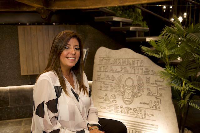
(MENAFN - Daily News Egypt) It all started as a regular designing project of the veteran award-winning architect Dalia El-Saadany. The timeworn building in the heart of downtown's AUC's GrEEK campus held nothing for her but the authenticity of last century when it was built. When the international ambassador of design stumbled upon what she saw as a 'time machine' that took her to another era, she felt others should explore it as well.

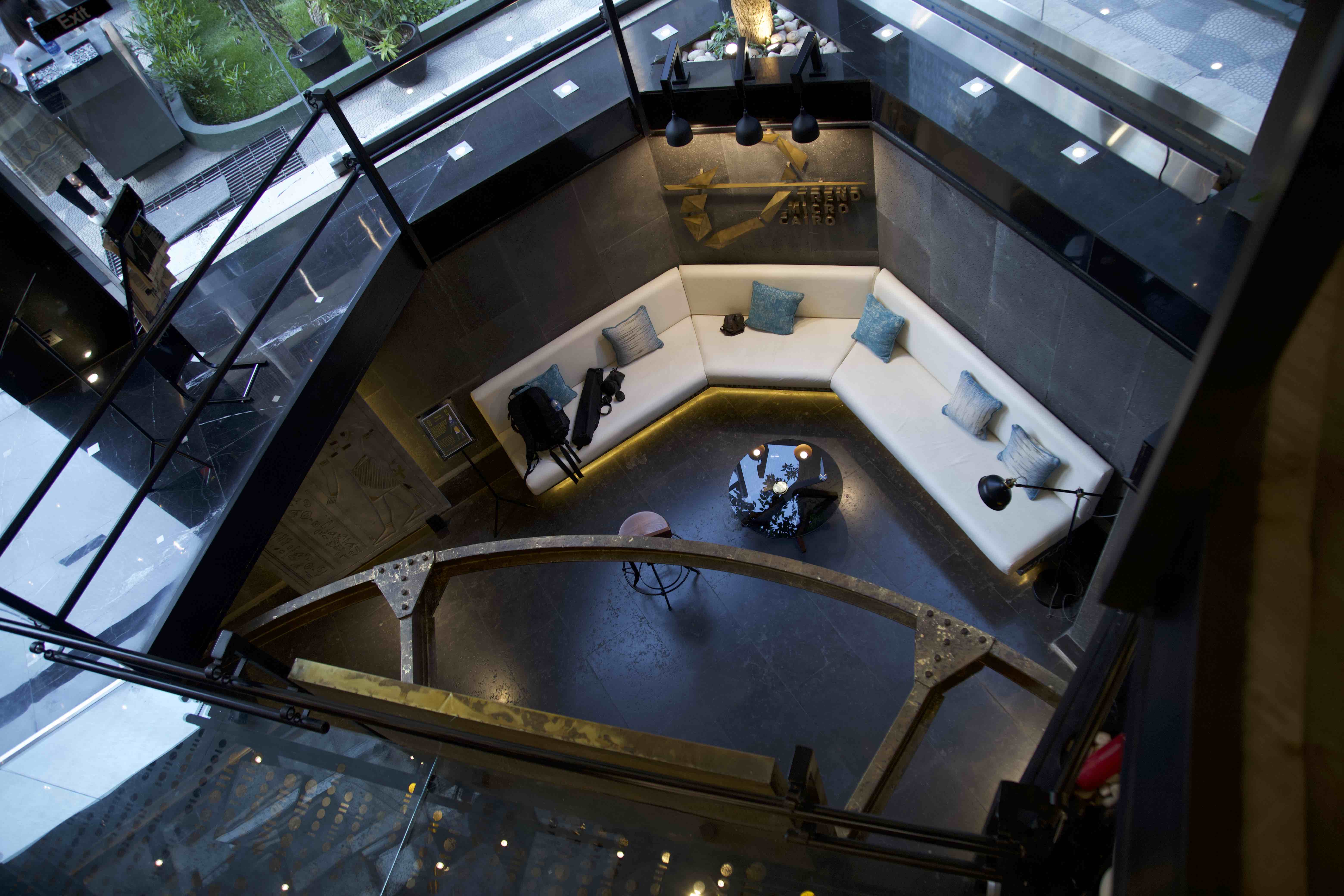
The giant theatre turning table machine, was the star of El-Saadany's fairytale which she soon turned into reality.

In a few months of intensive work, El-Saadany turned the basement of the private international information technology company into a museum in which she displayed the information she found proving that ancient Egyptians are the origin of this knowledge. This is proof that took her six months of continuous research.

The veteran architect's design won the Golden award in the International A'Design Award and Competition in Italy for the first qualitative museum. The award is one of the world's largest annual juried design competition that honours best designers, architects, and design-oriented companies worldwide. A large number of designers, almost 13,000, compete in more than 105 design fields from around the world.

Daily News Egypt interviewed El-Saadany to delve into her long journey of creating the basement from scratch, exploring where the idea came from, and the struggles she faced until reaching the 13th international award, the transcript for which is below, lightly edited for clarity:

What inspired you to come up with a design about the ancient Egyptian civilization?

There is not a single person that can show up telling you I was inspired by a certain thing. Anyone with a career about creativity, does get a light bulb that pops into one's head even maybe when he is asleep. But things happen, and they lead you into deciding the steps you should take in order to reach a certain design.

I was doing another design for the same company through which I was expanding the upper floor and redesigning it. When I was removing the flooring, I stumbled upon a hatch-door through which we crawled under ground to find an 80 cm height basement that has a huge 10 metre width machine. We later discovered it was a theatre turning table machine.

The moment I laid my eyes on the machine, I knew I wanted it. Discovering it, changed the whole designing plan - opening new aspects of ideas.

I decided to dig down for two metres to actually create an actual basement to expose the machinery.

Thinking that the machine is a turning table, opened a new path of thinking, of redesigning the whole building in order for the basement to be the past, the ground floor is the present, and the higher floor is the future. For me, it looked like a time machine, and I decided to actually let it take people in time and place to the past.

But why did you choose ancient Egyptian civilisation in particular?

I have studied and taught the history of architecture for as long as I remember. The more you read about history, the more it leads you into knowing more.

I have been reading about ancient Egyptians, and I know the civilisation is one of the most discreet ones. They did not want anyone to know anything about them. They are not friendly, and they did not want anyone to know anything about their science and knowledge. Up until this day, we are trying to figure out what they were doing.

I found a connection between the information security company and the ancient Egyptian civilisation; they both have a hierarchy. Both are connected to each other with the fact that not all employees or members get an access to the same amount of information. That's how I started gathering information about the information security on the ancient Egyptian civilisation. The research opened a whole door of knowledge that all clearly revealed that ancient Egyptians are the original creators of information security.

Would you please explain more about the connections you found between the two sides? How did you find out that ancient Egyptians were the origin of information security?

They both run the same method. Both work under the umbrella in which your class at the entity defines the amount of information you see. 

When you think of the concept of a 'password', it is documented that the pharaohs had rings with shapes that determine the amount of knowledge this person has access to. This is identical to the modern concept of a password that logs a certain individual into a certain amount of information, as well at the website.

When it comes to encryption, users see a number of letters and numbers no one but the people on the other side can read and transform into a set of readable useful information. Ancient Egyptians wrote on their archways holographically which is all about symbols, and within these symbols there were other drawings that, as a commoner, you cannot read. The people whom these drawings are sent to, perfectly understand the hidden sent message.

Throughout my six-month research, I've come to discover that the main concept of preservation of the information saw the light for the first time by the Pharaohs 7,000 years ago to save the information from real thieves, while firewalls are currently designed to save online data from hackers.

The ancient anti-virus, which is the aggressive way of stopping someone from getting inside, attack and kill them, is the same aspect of the curse of the pharaohs in which they used two chemical materials to interact with the oxygen leading to the creation of a hallucinating acid. So, they evacuated the tombs from the air, and when thieves got in the interaction of the two materials led them into seeing things attacking them.

What triggered you into reflecting the things you found, at the walls of the museum?

Throughout modern history, we have done nothing regarding our history but slightly showcasing it. We have not done much effort about it. I wanted to do something different, I wanted the world to know that modern Egyptians are as smart as the pharaohs. Finding all of this information led me to decide to take people to a trip into the history of what their company does, which is information security.

Did you get any help from sources other than research?

Yes! I got the help from a number of Egyptologists. They made sure that all of the inscriptions I am engraving on the walls are correct, because at a certain level, changing the wedge of the ducks' tail changes the meaning completely.

For a while, I wanted to engrave things on the ground, but they stopped me assuring that such things are sacred, and gods' names cannot be written on the floor.

They also told me that there are some gods I cannot put next to each other because they cannot be sitting next to each other in the ancient Egyptians beliefs.

What were the main challenges facing you building a third underground floor?

Underground water of course was the biggest, most challenging factor facing us. We were digging and all of the sudden we found water floating down from everywhere, and we were walking on very thin lines, not knowing the foundation.

We also did not have any technical drawings of the building. So, we did not know to what extent we can break away from the main structure. It is so much easier to build a new place than restoring an old one. 

What is the main message you aimed to deliver with this museum?

I wanted to put our foot down that we are not a part of history, we created history, and the west built upon that. I aimed for young people to read about their history because it tells a lot about how ancient Egyptians were the origins of several things, just like information security, astronomy, computer science, medicine, make up, and fashion. 

I wanted people to know that young generations started reading about history.


MENAFN0207201901530000ID1098715166

--   Sent from my Linux system.

Dive beneath the pyramids of Egypt’s black pharaohs

https://www.nationalgeographic.com/culture/2019/07/dive-ancient-pyramid-nuri-sudan/

--
Sent from my Linux system.

Monday, July 1, 2019

Egyptologist: The trench surrounding the oldest pyramid of Egypt was a model of the way to the afterlife | Science in Poland


http://scienceinpoland.pap.pl/en/news/news%2C77690%2Cegyptologist-trench-surrounding-oldest-pyramid-egypt-was-model-way-afterlife.html

https://www.archaeology.org/news/7793-190701-djoser-dry-moat

Egyptologist: The trench surrounding the oldest pyramid of Egypt was a model of the way to the afterlife

Part of the eastern edge of the "Dry Moat"          uncovered in 2018. Visible detached rock fragments obscure the          structure carved in its edge. (photo: K. Kuraszkiewicz/PCMA)
Part of the eastern edge of the "Dry Moat" uncovered in 2018. Visible detached rock fragments obscure the structure carved in its edge. (photo: K. Kuraszkiewicz/PCMA)

The huge, rectangular ditch carved around the oldest Egyptian pyramid - the Pyramid of Djoser - was a three-dimensional model of the deceased pharaoh`s way to the afterlife, believes Egyptologist Dr. Kamil O. Kuraszkiewicz.

Djoser (2667-2648 BC) was the first Egyptian pharaoh to be buried in a pyramid. For the first time in the history of Egypt, stone was used on such a large scale during this construction.

"However, no hieroglyphic inscriptions inside the pyramid present any concepts associated with the Egyptian afterlife and death" - says PAP. Kamil O. Kuraszkiewicz from the Department of Egyptology, Faculty of Oriental Studies, University of Warsaw.

According to his findings, some of the beliefs associated with the Egyptian afterlife could be reflected in reality. The so-called Dry Moat, a giant trench made on a rectangular plan (approx. 750 by 600 m) could be a three-dimensional model of the way of the deceased pharaoh to the afterlife. The trench surrounded the complex of the Pyramid of Djoser, including a large wall and adjacent chapels.

Fortunately, its fragment west of the Pyramid of Djoser was within the scope of the Polish-Egyptian archaeological mission, currently led by Kuraszkiewicz. Based on the results of nearly 20 years of excavations, the scientist has developed a new concept concerning the significance of this object.

So far, archaeologists have discovered there carved tombs of dignitaries of the 6th dynasty, several hundred years younger than the entire Pyramid of Djoser. Unusual, horizontal, low corridors drew their attention. According to the researchers, they could come from the time when the pyramid was erected. Their function has been a mystery.

One of the tunnels leading towards the pyramid ends after approx. 20 m with a small room. Inside, Polish archaeologists found an unusual ritual harpoon decorated with carved images of snakes.

"This weapon could be either one of the threats awaiting the king, or a weapon prepared for the ruler to be used against them" - the Egyptologist suggests. According to Egyptian beliefs, the way leading to the afterlife was difficult and dangerous. Before the deceased could enjoy eternal life, they had to overcome a series of obstacles and face dangerous creatures.

The researchers assumed that if the theory of the three-dimensional model of the way to the after-world was true, further similar corridors should be located near the previously discovered ones.

During the last excavation campaign in September 2018, in accordance with the researchers` expectations, a few meters south of the entrance to the previously discovered corridor they uncovered the outline of a rectangular hole carved in the bank, probably leading to further tunnels. The entrance is blocked by huge rock fragments. "We will try to enter the tunnel later this year" - the Egyptologist says.

Kuraszkiewicz has more evidence to support his theory. He mentions the strange structures in the western part of the "Dry Moat", discovered in the beginning of the 20th century. It was not just a flat-ended ditch. There are also transverse walls with crossings a few meters over the bottom, transitions, stairs, rows of deep niches of unknown purpose.

"The +Dry Moat+ could have been a model of the way that the dead king had to travel to achieve eternal life, a road with obstacles such as walls with high crossings, guarded by dangerous creatures. The niches could be designed for them" - he points out.

It is known that the first Pyramid Texts, inscriptions describing the pharaoh`s way to the afterlife, appeared inside the Egyptian pyramids only a few hundred years after Djoser`s rule. The contents of inscriptions are much older, the researchers have determined. They assume that the texts were written on papyri and placed in pyramids, and simply did not survive to our times - they were stolen or destroyed. Perhaps - as Kuraszkiewicz suggests - beliefs were also reflected in three-dimensional structures.

Today, the "Dry Moat" is almost entirely covered with debris and sand blown from the desert. It is completely invisible from the surface, but its outline can be seen on some aerial and satellite images.

Scholars have suggested that it was the boundary between the sphere of the sacred, that is, the royal tomb, and the profane, that is, all that was beyond it. According to others, it was a quarry, in which the material for the pyramid was mined, and did not have any other significant functions.

PAP - Science in Poland, Szymon Zdziebłowski

szz/ agt/ kap/

tr. RL


--   Sent from my Linux system.

Egypt Centre Collection Blog: The Ushabtis of the Divine Adoratrice Qedmerut


https://egyptcentrecollectionblog.blogspot.com/2019/07/the-ushabtis-of-divine-adoratrice.html

Monday, 1 July 2019

The Ushabtis of the Divine Adoratrice Qedmerut

In 2016 I was invited to Louvain-la-Neuve (Belgium) to participate in a conference relating to the excavations of the tomb of Karomama within the Ramesseum complex. Since the Ramesseum lies just across the road from the South Asasif necropolis, we are fortunate enough to see the temple of Ramesses II every day (fig. 1). As an undergraduate student at Swansea University, I undertook a life-cycle project on a rather special ushabti in the Egypt Centre collection (W1315), which had been misidentified several times over the years. Based on the rather scant traces of her name on the front, along with the iconography of the figures, it was possible to identify her as the Divine Adoratrice Qedmerut.

Fig. 1: Sunrise at the Ramesseum

Of all the women to have held the prominent title of Divine Adoratrice (dwꜣt nṯr), Qedmerut is perhaps the most obscure. Though her exact chronological position is uncertain, the typology of her ushabti figures makes her likely the direct successor of Karomama G Merytmut in the mid Twenty-second Dynasty (late ninth–early eighth century BC). Qedmerut is known exclusively from her ushabti figures, which were discovered by the Egyptian Research Account (ERA) within the Ramesseum in the late 1890s (Quibell 1898). These figures were subsequently dispersed to the various institutions and benefactors who subscribed to the ERA, especially within the United Kingdom. W1315 (fig. 2) arrived in Swansea from the British Museum in 1980.

Fig. 2: Front of W1315

The ushabtis of Qedmerut are moulded in faience and are noteworthy for their rather coarse and pitted surfaces. Aston (2009, 241 & 357) identifies them as his "Type F", which he describes as having crossed bands holding two opposed hoes, a solid unpainted wig bound by a headband, and the face modelled in a more "naturalistic" manner. A uraeus, a feature commonly found on the ushabtis of the Divine Adoratrice, is modelled on the forehead. All the details have been painted in black ink over the bluish-green glaze: a seshed-headband, large eyes, thick brows, small hoes, and a rectangular seed-bag at the rear suspended from long cords (fig. 3). Additionally, a single column of hieroglyphs, identifying the owner, is located on the front. The figures measure approximately 10 cm in height, 3 cm in width, and 2.5 cm in depth.

Fig. 3: Back of W1315

Due to the poor quality of many of the ushabtis, the inscriptions have often faded or are only partially visible as a result of the surface flaking. Yet, even without the inscription present, a number of key identifiers can be noted, besides the poor quality faience used in the production. The first is the uraeus, which is only found on royal ushabtis, including those of the Divine Adoratrice. However, amongst the Divine Adoratrices of the Third Intermediate Period, only those of Qedmerut and Karomama G appear to wear one. The main difference between the figures of these two women is the size (Moje 2017). At a maximum of 10 cm in height, Qedmerut's ushabtis are significantly smaller than those of Karomama G, which have a minimum height of 13–14 cm (fig. 4). Thus, combining these elements can often lead to the identification of Qedmerut's ushabtis that have either a missing or partially damaged inscription.

Fig. 4: Ushabti comparison of the Divine Adoratrices Maatkare, Henuttawy, Mekhetemweskhet, Karomama, Qedmerut

The ushabtis of Qedmerut all contain a single column of text identifying the owner. Two main variants are attested, which I have designated as Type A and B (fig. 5). In both cases, the title of dwꜣt nṯr is enclosed within the cartouche, an arrangement that only occurs for the ushabtis of Henettawy D and Qedmerut. ln many cases the inscription has faded, although it is still possible from surviving traces to determine the type for almost all figures: Type A occurs fifteen times, Type B is found on twenty-five figures, while for eight of them it is impossible to determine. 

Fig. 5: Type of inscriptions on the ushabtis of Qedmerut

In the 2017 proceedings of the conference, I published a catalogue of the forty ushabtis of Qedmerut known to me. Since then, a further eight have come to light, some of which were kindly brought to my attention by Glenn Janes, thus bringing their number to forty-eight. These new examples are: one in the Museum of Archaeology and Anthropology, Cambridge (2006.152), at least six in the Pennsylvania University Museum (E1898, E14598, E14599, E14600E14670, E14672), one sold by the Helios Gallery in 2017, and another to be sold by Bonhams auction house on Wednesday 3 July 2019. With the recent rediscovery of Karomama's tomb within the Ramesseum complex (fig. 6), it is hoped that the burial place of Qedmerut will follow suit, perhaps shedding additional light on the identity of this mysterious woman.

Fig. 6: Shaft tomb of Karomama

Bibliography:
Aston, D. A. (2009) Burial Assemblages of Dynasty 21–25: Chronology - Typology - Developments. Contributions to the Chronology of the Eastern Mediterranean 21; Denkschriften der Gesamtakademie 54. Vienna: Verlag der Österreichischen Akademie der Wissenschaften.
Ayad, M. F. (2009) God's Wife, God's Servant: The God's Wife of Amun (ca.740–525 BC). London: Routledge.
Griffin, K. (2017) 'The Ushabtis of the Divine Adoratrice Qedmerut'. In De la mère du roi à l'épouse du dieu. Première synthèse des résultats de la fouille du temple de Touy et de la tombe de Karomama – Von der Königsmutter zur Gottesgemahlin. Erste Synthese der Ausgrabungsergebnisse des Tempels von Tuja und des Grabes von Karomama, ed. B. Lurson. Connaissance de l'Egypte Ancienne 18. Brussels: Safran. 145–155.
Lurson, B. and F. Mourot (2018) 'From the Foundations to the Excavation: A Stratigraphy-based History of the Temple of Tuya'. In Thebes in the First Millennium BC: Art and Archaeology of the Kushite Period and Beyond, ed. E. Pischikova, J. Budka and K. Griffin. GHP Egyptology 27. London: Golden House Publications. 193–213.
Moje, J. (2017) 'Die Uschebtis von Karomama Meritmut G – ein Überblick'. In De la mère du roi à l'épouse du dieu. Première synthèse des résultats de la fouille du temple de Touy et de la tombe de Karomama – Von der Königsmutter zur Gottesgemahlin. Erste Synthese der Ausgrabungsergebnisse des Tempels von Tuja und des Grabes von Karomama, ed. B. Lurson. Connaissance de l'Egypte Ancienne 18. Brussels: Safran. 103–112.
Nelson, M. (2003) 'The Ramesseum Necropolis'. In The Theban Necropolis: Past, Present and Future, ed. N. C. Strudwick and J. H. Taylor. London: British Museum Press. 88–94.
Quibell, J. E. (1898) The Ramesseum. Egyptian Research Account 2. London: Bernard Quaritch.
--   Sent from my Linux system.

Egypt Centre Collection Blog: News from Luxor: Reconstructing a Fragmentary Middle Kingdom Stela


https://egyptcentrecollectionblog.blogspot.com/2019/06/news-from-luxor-reconstructing.html

Monday, 24 June 2019


News from Luxor: Reconstructing a Fragmentary Middle Kingdom Stela

This past Saturday I arrived in Luxor, which will be my home for the next four weeks. I'll be joining up with the South Asasif Conservation Project (SACP), directed by Dr Elena Pischikova, a project I've been involved in since 2010. My role on the project is as an epigrapher, working mainly on reconstructing the religious texts in the tomb of Karakhamun (TT 223). In particular, my work this season will focus on helping the team reconstruct the Ritual of the Hours of the Night, which was inscribed on the southern pillars within the First Pillared Hall of the tomb (fig. 1). While the tomb had completely collapsed in fairly modern times, over 20,000 inscribed fragments have been recovered from the floor since 2006. As a result, the reconstruction of the monument is a giant jigsaw puzzle!

Fig. 1: Reconstructed vignette of the Seventh Hour of the Night

In preparation for my trip to Luxor, I decided to look at two related boxes in the Egypt Centre store. One was labelled as "stela", while the other contained just over forty fragments of broken limestone (fig. 2). These fragments, which carry the accession number EC1848, were originally part of the collection of Charles James Tabor (1849–1928), a British businessman, bibliophile, lecturer of folklore, and collector of 'curios' (Hardwick 2012, 49). They were sold as part of lot 235 on the 13 November 1928, with the auction catalogue describing it as "six sepulchral stele in limestone". No details of its provenance are recorded. The lot was purchased by Harry Stow, a long-term buyer for Henry Wellcome, for the sum of £19/10. The Egypt Centre has at least three other objects (W348, W349, W1710) allegedly from this lot, although two of them are sandstone!

Fig. 2: Fragments of EC1848 before reconstruction

Using the experience gained through my work with the South Asasif Conservation Project, I spent a day trying to piece the fragments together. Several fragments had been previously glued together at an unknown date, perhaps by the late Anthony Donohue (1944–2016), who worked on the collection for many years. The largest fragment contains the upper figure of a man carved in sunk relief, with a table of offerings above. Traces of an inscription are located above this. Thus, it was already clear that EC1848 contained at least three registers (fig. 3). Stylistically, the stela can be dated to the Middle Kingdom, specifically the late Twelfth or Thirteenth Dynasties.

Fig. 3: Largest fragment of EC1848 before joins

Following a quick examination of all the fragments, around half of which contained decoration, I was able to join two of the larger fragments to the inscription at the top. This revealed that the text consisted of at least four lines of hieroglyphs (fig. 4). While fragmentary, it was possible to reconstruct a part of it. On the second line is the well-known phrase n-kꜢ-n, "for the ka of", which traditionally precedes the name of the deceased. Unfortunately, this name is missing. Line 3 has ir-n ḥꜢty-Ꜥ wr [...], "made by the Governor [...]". This identifies the father of the deceased, whose name perhaps begins Wer-[...]. Finally, on the bottom line, the inscription provides the title and name of the owner's mother: nbt-pr Bbi͗ mꜢꜤt-ḫrw, "Mistress of the House, Bebi, the justified". The name Bebi is well attested for both males and females of the Middle Kingdom (Ranke PN, 95. 16).

Fig. 4: Upper register inscription during reconstruction

Several joins were made to the scene in the central register, which allows for a reconstruction of a large offering table with a duck on top and drinking vessels below (fig. 5). To the right is a fragment containing the upper body and arm of a person, perhaps seemingly sniffing a lotus blossom. To the left of the table, only the remains of a toe from another figure and the base of a staff are present. This would suggest that we have a seated male figure (the owner of the stela) on the left side, and a female figure (likely his wife) on the right (Budge 1912, pl. 22). In the centre of the lower register, a male figure is depicted looking to the right. The inscription in front of him reads sꜢ.s sꜢ-ḥwt-ḥr, "Her son, Sahathor". Sahathor, meaning "son of the goddess Hathor" is another common name in the Middle Kingdom (Ranke PN, 283. 20). Directly behind him is a column of hieroglyphs, which reads as ḫw-ni͗wt.f mꜢꜤ-ḫrw, "Khuniwtef, the justified". This name is much rarer, although it is attested on a stela in Cairo (CG 20134), which also dates to the Middle Kingdom (Lange & Schäfer 1902–1925 I, 158). I am grateful to Wolfram Grajetzki for bringing this stela to my attention!

Fig. 5: Reconstruction of EC1848

Despite ten new joins to the stela being made, around thirty more fragments (mainly undercoated) remain. From the decorated fragments, three contain traces of arms holding flowers. One of them even includes the partial inscription sꜢt.f [...]-ḥwt-ḥr, "his daughter, [...]-Hathor". It is thus clear that we have in the Egypt Centre a rather fragmentary family stela dating to the late Middle Kingdom.

Bibliography: 
Budge, E. A. W. (1912) Hieroglyphic Texts from Egyptian Stelae, &c., in the British Museum. Part II. London: The British Museum.
Franke, D. and M. Marée (2013) Egyptian Stelae in the British Museum from the 13th–17th Dynasties. Volume I, Fascicule 1: Descriptions. London: British Museum.
Griffin, K. (2018) 'A Preliminary Report on the Hours of the Night in the Tomb of Karakhamun (TT 223)'. In Thebes in the First Millennium BC: Art and Archaeology of the Kushite Period and Beyond, ed. E. Pischikova, J. Budka and K. Griffin. GHP Egyptology 27. London: Golden House Publications. 59–70.
Hardwick, T. (2012) 'The Obsidian King's Origins: Further Light on Purchasers and Prices at the MacGregor Sale, 1922'. Discussions in Egyptology 65: 7–52.
Lange, H. O. and H. Schäfer (1902–1925) Grab- und Denksteine des Mittleren Reichs (CG; 20001–20780). 1–4. Catalogue général des du Musée du Caire. Berlin: Reichsdruckerei.
Ranke, H. (1935) Die ägyptischen Personennamen, vol. 1. Glückstadt: Verlag J. J. Augustin.
Sotheby, Wilkinson & Hodge. (1928) Catalogue of Prehistoric Implements, Egyptian, Greek and Roman Antiquities, &c.: Monday, the 12th of November, 1928, and Following Day. London: Sotheby, Wilkinson & Hodge.
--   Sent from my Linux system.

AWOL - The Ancient World Online: Open Access Journal: Horizon: The Amarna Project and Amarna Trust Newsletter


http://ancientworldonline.blogspot.com/2010/03/open-access-journal-horizon.html
On 07/01/2019 07:50 AM, Chuck Jones wrote:
Open Access Journal: Horizon: The Amarna Project and Amarna Trust Newsletter  [First posted in AWL 1 March 2010. Updated 1 July 2019]

Horizon: The Amarna Project and Amarna Trust Newsletter
Amarna Project Home
The ancient Egyptian city of Tell el-Amarna (or simply Amarna) was the short-lived capital built by the 'heretic' Pharaoh Akhenaten and abandoned shortly after his death (c. 1332 BCE). It was here that he pursued his vision of a society dedicated to the cult of one god, the power of the sun (the Aten). As well as this historic interest Amarna remains the largest readily accessible living-site from ancient Egypt. It is thus simultaneously the key to a chapter in the history of religious experience and to a fuller understanding of what it was like to be an ancient Egyptian. There is no other site like it.

Horizon Issue 19 | Autumn 2018

In this issue:

  • Amarna Study Day (Double Issue)
  • Great Aten Temple newly revealed
  • Understanding Statuary from the Great Aten Temple
  • Understanding and Protecting Amarna in the 21st Century
Issue 17
Spring 2016
Issue 16
Summer 2015
Issue 15
Autumn 2014
Issue 14
Spring 2014
Issue 13
Summer 2013
Issue 12
Spring 2013
Issue 11
Summer 2012
Issue 10
Winter 2012
Issue 9
Summer 2011
Issue 8
Winter 2010
Issue 7
Spring 2010
Issue 6
Autumn 2009
Issue 5
March 2009
Issue 4
September 2008
Issue 3
April 2008
Issue 2
July 2007
Issue 1
October 2006


--   Sent from my Linux system.