http://english.ahram.org.eg/NewsContent/1/64/341911/Egypt/Politics-/In-Photos--Magnificent-Cairo.aspx
In Photos: Magnificent Cairo
Nader Habib marks 1,050 years since the foundation of the Orient's oldest jewel, the city of Cairo, by taking a tour through some classic books
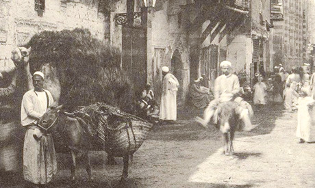
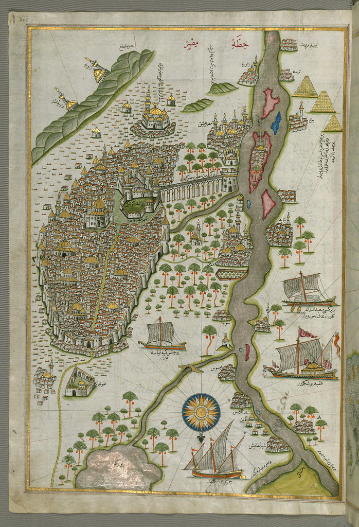
From Old Cairo, which has maintained its historic ambiance and boundaries, was born modern Cairo that has since expanded and developed to become the capital we see today. The history covering the period from 969 CE until the present is told in three books released by the General Egyptian Book Organisation, among other places.
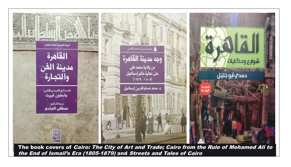
Cairo: The City of Art and Trade authored by 20th-century French orientalist Gaston Wiet (1887-1971) tells the story of Cairo from the time it was founded until the Ottoman era. Egyptian historian Mohamed Hossameddin Ismail's Cairo from the Rule of Mohamed Ali to the End of Ismail's Era (1805-1879) focuses on the role of the French campaign in Egypt at the end of the 18th century in shaping a new idea of Cairo that later inspired Mohamed Ali and his sons and grandsons to build a modern capital that would be even more captivating than the Western cities of the time.
The third book, Streets and Tales of Cairo by Egyptian writer Hamdi Abu Galil, takes the reader on a journey through the history of Cairo from the 23 July 1952 Revolution to the present day. Abu Galil relates the tales of streets and their names in the city, explaining that while some believe that governments designate names for streets, in fact it is the people that name their streets themselves.
He says that a number of Cairo streets bear two names: an official one given by the government and a popular name immortalised in the nation's memory.
THE VICTORIOUS
In his book, Wiet writes that Cairo was named after a fateful incident.
On the night the Fatimid army commander Al-Siqilli arrived in Fustat, Egypt's first Islamic capital, he drew up a plan for the walls that would eventually surround the city of Cairo to the north. He also laid the foundation stone of the royal palace from which Al-Muizz would govern it.
Because Al-Siqilli wanted Cairo's rulers to be of the same bloodline, he gathered many fortune-tellers and ordered them to choose an auspicious symbol for the foundation of the city and another for the foundation stone. The fortune-tellers erected wooden planks around the Cairo walls and connected them with ropes on which they hung bells. They asked the builders to throw the bricks they were carrying down as soon as they heard the bells.
Unfortunately, a crow then landed on a wooden plank, setting off the bells. The workmen duly threw down their bricks, at which point the fortune-tellers said, "the Victorious is strong." Victorious was the name of the planet Mars, rising at the time, and from then onwards Al-Qahera, meaning the Victorious, became the name of the city that became the largest and most dazzling in the region.
Cairo's foundation stone was laid on 6 July 969 CE, and the city was originally designed to house the caliph, the army commanders and soldiers. Houses were built for the soldiers and their families, and around them sprung up shops to serve them.
As the walls grew higher, palaces and the Al-Azhar Mosque were built. Al-Siqilli's soldiers began building more and more houses, gradually converting an army camp into a fully-fledged city. When the land within the Cairo walls was divided among the different army regiments, each named their area after the name of their regiment or commander.
Cairo at this time was divided into two equal sections by a barrier stretching across it. West of this, parks extended all the way to the River Nile, and these changed their aspect with the annual flooding of the Nile. It was customary for the caliph to head to a pavilion erected on a hill to observe popular festivals.
Because of the large size of the city, shop owners were obliged to keep a bucket of water in front of their stores at all times to put out fires. The caliph issued a decree stating that shops, gates, squares, roads and alleyways should all be lit, and this led people to overuse lighting in the streets. Cairo's markets were thus extravagantly lit throughout the night.
There were some 20,000 stores in Cairo at the time, each owned by the Sultan who also owned all public buildings and bathhouses. The Sultan also had some 20,000 houses that he rented out. There was no fortress in Cairo at the time like the present citadel, but many of its buildings were like fortresses in size, and some stood five or six storeys high. Each palace resembled a mini-citadel, and between them there was greenery and parks watered from wells. Everything was meticulously landscaped.
According to Wiet, Cairo's houses were extremely elegant, to the point that one might think of them as being built of precious jewels and not of stone. Houses stood at a long distance from each other, and the trees near one house never touched those near another. The city mesmerised its visitors and inhabitants alike.
With time, the city expanded to the south until it reached the older capital of Fustat, connecting the two cities where the Al-Sayeda Nafisa Mosque stands today. In its earliest years, the walls of the city were made of mudbrick, but towards the end of the 11th century, Badr Al-Gammali, appointed a minister in 1073, took down the walls and erected stronger ones made of stone. The new walls were fine examples of the architectural art of the time, and this can still be seen today in the three gates of Bab Zewaila to the south and Bab Al-Nasr and Bab Al-Fotouh to the north.
The Cairo walls were meant to protect the city against enemy attacks. However, their many defence mechanisms were never used, including the sliding gates and the boiling oil and melted lead that could be prepared ready to be poured down over enemies' heads.
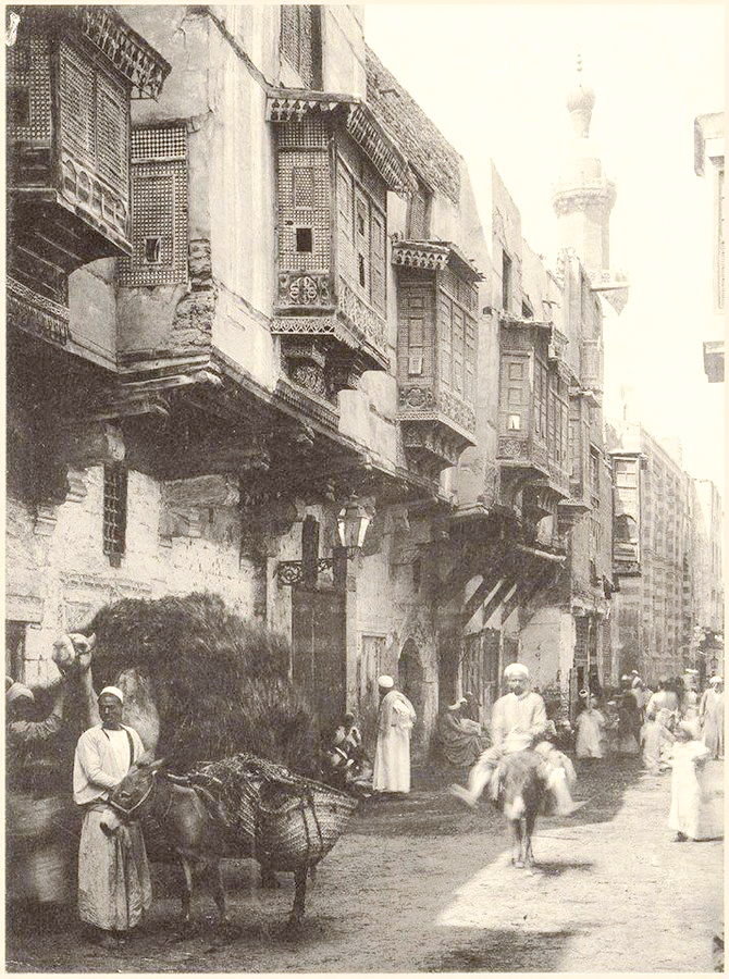
The remains of the Fatimid city today can be seen in the road extending from north to south in Islamic Cairo and in alleyways and breath-taking monuments in the area such as the Al-Azhar, Al-Aqmar and Al-Hakim Mosques.
CHANGING FACES
Cairo's rulers came and went, until Salaheddin Al-Ayoubi (Saladin) took power and set up a new ruling area away from the people and the officials loyal to the former Fatimid governments.
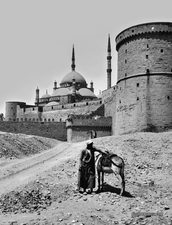
He gave instructions for a citadel to be built in the Moqattam Hills overlooking Cairo, tearing down various mosques and cemeteries in the area to do so as well as a small pyramid in Giza that was used to provide the stone to build the new Cairo Citadel.
Salaheddin wanted to build a single set of walls around Cairo, Fustat and the citadel, but he died before the walls and the citadel could be completed. Construction on the citadel began in 1176 and ended in 1207.
The Egyptian historian Taqieddin Al-Maqrizi later wrote that Salaheddin had ordered the construction of the citadel because when he rooted out Fatimid rule in Egypt, he feared the retaliation of Shia Muslims loyal to the Fatimids. The historian added that as was the habit of rulers at that time, Salaheddin had wanted to wipe out all trace of his predecessors and erase the memory of his enemies.
He thus altered the character of the Fatimid city and made it into a place in which the public could wander freely. He decreased the size of the caliph's palace, tearing down a part of it and turning the other into private houses. By building the citadel, he wanted to mark a break with the past, as it acted to change customary habits and the former social mould. The location of the citadel also allowed government offices to function behind high walls, away from the threat of possible revolts.
With the advent of the Ayoubid period and the city's increasing population, Cairo also began to expand. As it stretched southwards to connect with Fustat, the latter became a port on the Nile and the strip between the two cities became an awe-inspiring set of gardens that maintained their beauty until the early 14th century.
The city also expanded to the west towards the Nile, with Boulaq becoming a new area on the river and competing with Fustat as a port. This expansion contributed to changes in the character of Fustat, particularly when the Sultan constructed a new fortress on Roda Island between Fustat in the east and Giza in the west. Fustat rose to prominence and numerous emirs and others moved there.
Yet, instead of founding an entirely new capital, Salaheddin effectively joined the city's four original areas together, making a single conurbation out of Fustat, Askar, Quataa and Fatimid Cairo. Together, the four areas became the new capital of Cairo, taking the city out of its old walls towards the Cairo Citadel, which remained the headquarters of the different rulers that arose following Ayoubid rule. It remained the seat of power until the khedive Ismail moved to Abidine Palace in the later 19th century.
Under Ayoubid rule, Salaheddin's trusted official Bahaaeddin Qaraqoush was assigned the task of expanding the Cairo walls to encompass the city's new parameters. He extended the walls from Bab Al-Qantara to Bab Al-Sheariya and Bab al-Bahr and Bab Al-Nasr to the citadel.
The water wheels and aqueduct that used to carry water to the citadel at the time are still standing today, reminding visitors of Cairo of the Ayoubid era.
THE MAMELUKES
This period was Cairo's golden age, especially after the repercussions of the European Crusades in the Levant had receded and Egypt's ruling Mamelukes had triumphed over the invading Mongols.
During the rule of the Mameluke Sultan Baybars, Cairo stretched to the north beyond the walls in the Husseiniya district. A new mosque was built and named after Baybars, while in the citadel more buildings were constructed. More markets were opened, more bridges were extended, and more water wheels were constructed during Baybars's rule.
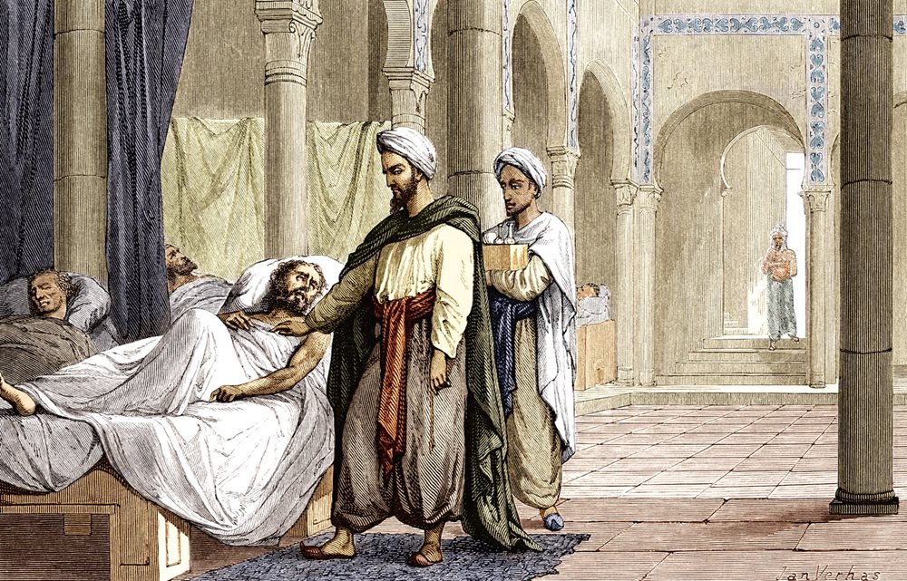
The emirs of the period built houses, mosques and bathhouses, contributing to the architectural beauty that became synonymous with Cairo. The Mameluke Qalawun dynasty that ruled Egypt for approximately 100 years saw the Sultan Al-Mansur Qalawun construct a host of buildings, including a famous mausoleum and school. He constructed a hospital that would treat the entire population, from the poorest to the wealthiest, and part of this still stands today as a testament to the grandeur of the city at the time.
It is estimated that some 4,000 patients were treated a day in the hospital in the 14th century. Upon leaving it each patient was given a sum of money and clothes. It is said that the food at the hospital was prepared with the utmost care. A Moroccan traveller said that the hospital's furniture was as valuable as that of palaces and that the entire staff was marvellously dedicated.
The document drawn up in Al-Mansur Qalawun's name establishing the hospital reads that "the greatest good deeds are those that provide comfort to others. Therefore, men should make the poor who become sick happy by providing them with housing and healthcare. They should start with the poorest of the sick, the weak and the needy."
The hospital was built to treat all Muslim men and women. Medicines were given out to patients whose illnesses did not require a stay at the hospital, and the building itself was divided into wards for physical and psychological treatments. Receipts from the hospital show unexpected purchases, such as fans made of palm fronds bought in to ensure the comfort of patients in the summer heat.
Under the Qalawun dynasty, Cairo extended to the north and west, thanks to the deposits of the River Nile that gradually turned the desert in the west to land suitable for agriculture.
Mameluke princes built schools, mosques, bathhouses, water fountains and shrines, and they competed amongst each other to build architectural marvels. The city was prosperous, and trade flourished. Al-Mansur Qalawun became passionate about architecture and constructed many lavish buildings. Beneath the citadel he built exhibition grounds to host competitions between princes. He also restored many palaces in the citadel and built a mosque with two minarets that still stands today.
At this time, the Moroccan traveller Ibn Battuta visited Cairo in 1326, writing that it was "victorious over other nations and its kings ruled over the Arabs and the Ajam [non-Arabic speakers]." The historian Al-Maqrizi was also born at this time, and he wrote an invaluable history of Egypt, mentioning the enchanting architecture and arts of Cairo. From this time also comes the mosque and school of Sultan Hassan bin Qalawun, which is still considered to be one of the most beautiful in Cairo.
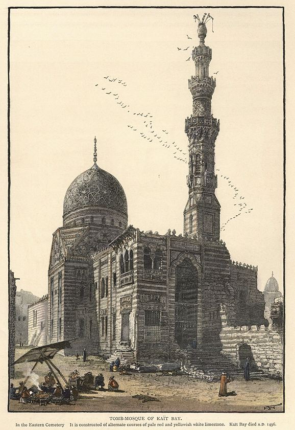
The Burji dynasty of Circassian Mamelukes had a particularly refined taste, expressed in the dazzling architectural style of their buildings. Their Sultans and princes constructed buildings such as the Al-Zahir Barquq Mosque, School and Mausoleum, the Mosque of Sultan Al-Muayid, the Mosque of Sultan Al-Ashraf Barsbay, the Mosque of Sultan Al-Ashraf Qaitbey, and the Mosque of Sultan Qansuh Al-Ghuri.
When the Ottoman Sultan Selim I conquered Egypt in 1517 CE, he gave the title of pasha to its new Ottoman governor. From the period of Ottoman rule several monuments remain, such as the Mosque of Mohamed Abul-Dahab near the Al-Azhar Mosque. An early katkhuda, or governor, of Egypt, Abdel-Rahman Gawish, was infatuated with architecture, and he built or remodelled numerous libraries, mosques, mausoleums and sabil-kuttabs (schools and water fountains). One of his better known sabils is located at the intersection between the Nahaseen and Gammaliya streets in Islamic Cairo.
The katkhuda also added a mihrab (prayer niche), pulpit, and gate to the Al-Azhar Mosque. On the upper floor, he opened a school to educate orphaned children.
MOHAMED ALI
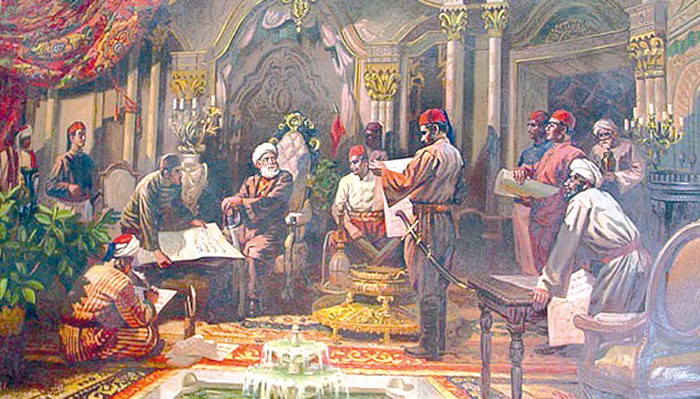
In Cairo from the Rule of Mohamed Ali to the End of Ismail's Era (1805-1879), Egyptian historian Mohamed Hossameddin Ismail writes about the early 19th-century ruler Mohamed Ali who founded the last ruling dynasty in Egypt, laid the foundations of the country's modern renaissance, and took Egypt away from the decay that had characterised it during Ottoman rule to place it among the developed countries of the time.
A natural-born leader, Mohamed Ali realised that the only way for the country to progress was to focus on upgrading education, industry and agriculture. He established modern schools, sent scientific missions abroad, re-organised the army and government administration, and built industrial complexes, many of which were concentrated in the Sabtiya district.
He built bridges, water wheels, and tunnels and paid special attention to the organisation and expansion of Cairo. He lit the city's streets and removed the debris filling them. In 1834, he formed a committee to oversee the beautification of Cairo and assigned artists and labourers from France, Italy and Turkey to build palaces on the condition that Egyptians would accompany them to learn their craft.
Among the palaces Mohamed Ali constructed are the Gawhara, Qubba, Haram, Azbakiya and Nil palaces, and he also built the famous mosque bearing his name in the Cairo Citadel. This Mohamed Ali Mosque was modelled after the Blue Mosque in Istanbul.
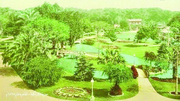
In April 1847, Ibrahim Pasha became Egypt's wali, or viceroy, after the death of his father. He focused on reinforcing the army and navy, formed a bar association to organise the flow of lawsuits, and built the Roda and High palaces. During Ibrahim's rule, the Azbakiya Lake was filled in, and in its stead a huge park was outlined.
The next ruler, Abbas I, gave a concession to the British in 1851 to establish the Cairo-Alexandria railway. He founded the Abbasiya district in the desert northeast of Cairo in 1849 with the purpose of establishing military barracks, a palace, a military school and a hospital.
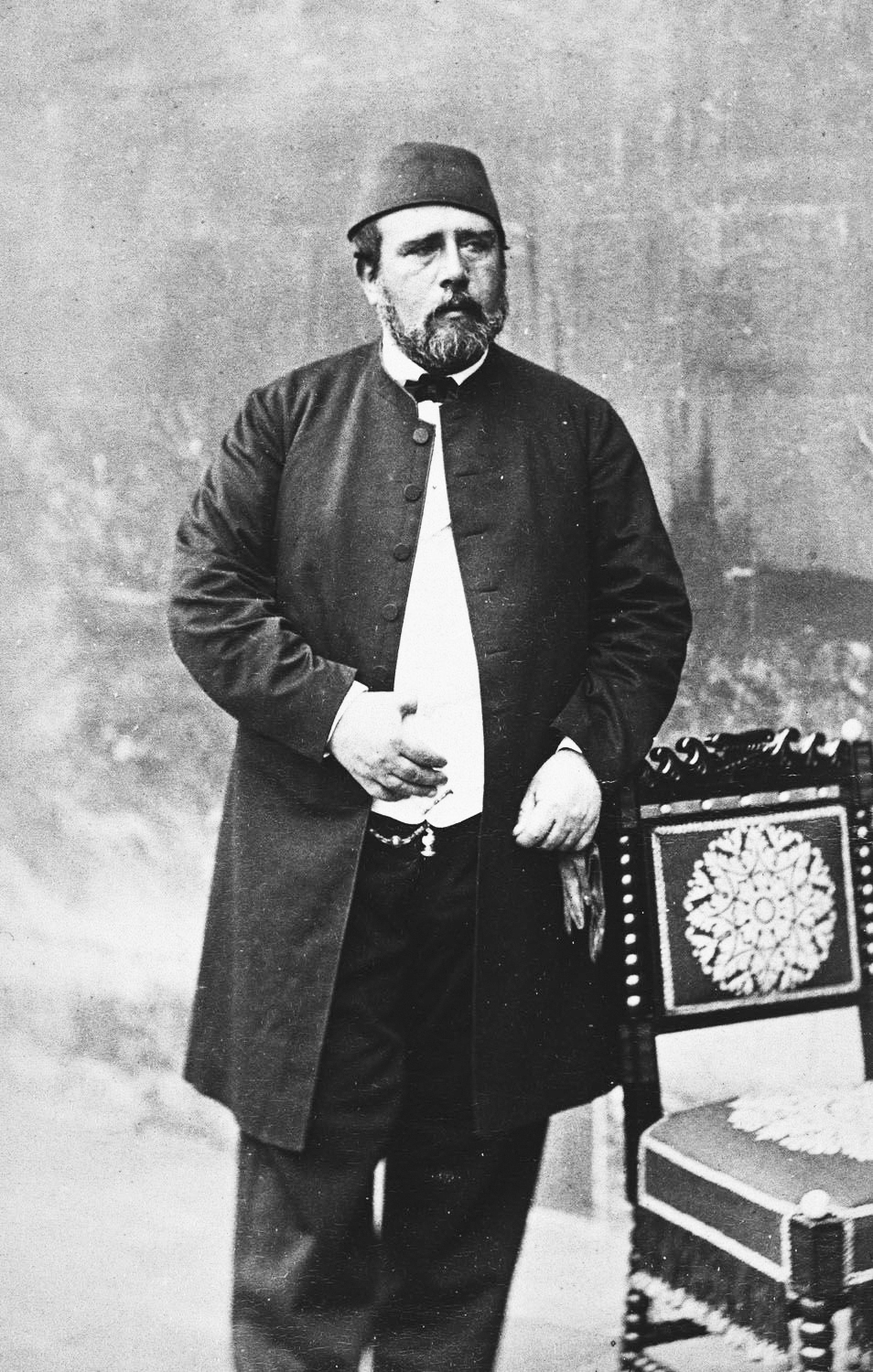
After the death of Abbas, Said Pasha succeeded to the throne, overseeing the opening of the Cairo-Alexandria Railway in 1854 and the building of Cairo's main railway station in Bab Al-Hadid in 1856. Said died in 1863, and the throne passed to Ismail Pasha, the first ruler to be given the title of khedive and the man responsible for the building of 19th-century Khedival Cairo.
Ismail gave Cairo a facelift and his contributions to the capital are etched on its walls.
When he took power, Cairo's population was 270,000, and it extended from the citadel in the east to Azbakiya in the west. Ismail went on to create an urban revolution in Cairo intended to lift the capital to rival those of the European countries and for Cairo to become the "Paris of the Orient".
Baron Haussmann, who redesigned Paris under Napoleon III in the 1860s, began work to remodel Cairo after Paris. It took five years for Haussmann to execute his plans, and in 1872 Ismail inaugurated Mohamed Ali Street in Downtown Cairo. Later, he established an opera house and library and built the Abidine Palace, the construction of which began in 1863.
The Qasr Al-Nil and Abul-Ela bridges connecting Cairo with Zamalek and Giza were built under Ismail, who also introduced the metro to Cairo, though it was only later in 1896 that Ataba was connected to Abbasiya.
THE MODERN CITY
A the beginning of the 20th century, Cairo witnessed major developments with the arrival of foreign businessmen and the introduction of businesses that would later grow exponentially.
There were further expansions with the connection of Cairo to the suburb of Shubra in 1902 and of the Al-Zaher area with Al-Sayeda Zeinab and Azbakiya in 1903. The districts of Faggala and Tawfikiya came into being, and Garden City was established in 1906, Zamalek in 1905, Heliopolis in 1906 and Maadi in 1907.
Cairo was the centre of protests against British rule during the 1919 Revolution, and the demonstrators used the house of nationalist politician Saad Zaghloul (the House of the Nation) as their headquarters. The Misr Bank was established in the 1920s, and Cairo became the centre for various companies.
In 1921, the Egyptian capital was selected to host an important meeting of European and Middle Eastern leaders to deliberate on the repercussions of World War I. It also won an award as the cleanest city in the Mediterranean for its grandiose buildings, clean streets,and organised traffic.
In his Streets and Tales of Cairo, Abu Galil recounts stories about Cairo's streets, why they were given such names, and whether their names changed with the succession of events. He mentions Port Said Street, for example, which was earlier called Canal Street as boats used to sail along its then canal in scenes reminiscent of Venice. Today, the street has become a main route through Cairo, with trucks moving up and down it transporting goods and earning it the name change.
Some street names have changed for political reasons, such as those that changed after the 1952 Revolution. Ibrahim Pasha Street became Al-Gomhouriya Street, for example, and Farouk Street became Al-Geish Street. Fouad Street became 26 July Street, and Queen Street became Ramses Street.
Other street names were given as a way of flattering foreign powers. Abdel-Aziz Street was given this name by the khedive Ismail when the Ottoman Sultan visited Egypt. To forge closer ties with the Latin American countries, the post-1952 Revolution government created Latin America Street and Simon Bolivar Square.
However, streets named after foreign powers usually have their names changed when political relations turn sour. An example is the street named after Saudi king Abdul-Aziz. Disagreements between Saudi Arabi and Egypt under former president Gamal Abdel-Nasser during the Yemen War in the 1960s led to a change in the name of this street. After the two regimes ended their disagreements, the street was re-named after king Abdul-Aziz.
Over the past 1,050 years of its existence, Cairo has never ceased to impress and inspire. Its allure increased when the country's rulers appreciated its value and understood its charms. Today, even as the city's administrative functions are soon to be relocated to the New Administrative Capital to the east, Cairo's special charm remains forever etched in the hearts of all Egyptians.
*A version of this article appears in print in the 31 July, 2019 edition of Al-Ahram Weekly under the headline: Magnificent Cairo
-- Sent from my Linux system.
No comments:
Post a Comment