https://www.heritagedaily.com/2018/02/pyramids-kingdom-kush/118369
Pyramids of the Kingdom of Kush – Map
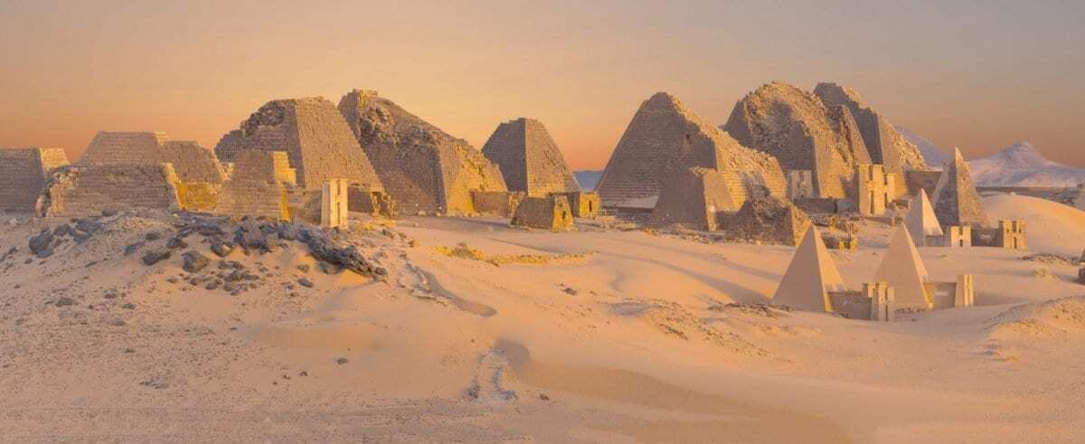
Image Credit : Valerian Guillot
The Kingdom of Kush was an ancient African kingdom located in Nubia, a region along the Nile rivers encompassing the areas between what is today central Sudan and southern Egypt.
The region was home to three periods of Kushite development through antiquity. The first had its capital based at Kerma (2600–1520 BCE) which was Nubia's first centralised state with an indigenous form of architecture and burial customs.
The second was centred on Napata (1000–300 BCE), with the last kingdom being centred at Meroë (300 BCE–300 CE). Both later Kingdoms saw a close influence develop from the customs and burial practices of Ancient Egypt.
In the 8th century BCE, King Piye invaded Egypt and established the twenty fifth dynasty of rule across the Egyptian Empire, uniting both kingdoms in the Nile valley that stretched from the delta to the city of Napata.
The twenty fifth dynasty Pharaohs built or restored temples and monuments throughout the Nile valley, including Memphis, Karnak, Kawa, and Jebel Barkal. Their reign also saw the first widespread construction of pyramids not seen since the pharaohs of the Middle Kingdom.
After around 100 years of rule, control of Egypt and its territories ended after the invading conquests of the Assyrians who placed a native Egyptian ruler, Psamtik I on the throne.
Kushite civilisation continued for several centuries until a series of crippling wars with the Roman Empire around the 1st to 2nd century CE would lead to a gradual decline. By the mid-sixth century CE the Kingdom of Kush was dissolved.
Kushite (Nubian) Pyramids
Archaeologists have accounted for more than 255 pyramids, built across four royal pyramid field sites in Nubia (El-Kurru, Nuri, Meroe & Jebel Barkal or Gebel Barkal).
More recently a fourth pyramid field of some 35 small pyramids was uncovered by archaeologists near Sedeinga. Whilst burial at El-Kurru, Nuri and Meroe were reserved for royalty, the Sedeinga Pyramids were constructed mainly for wealthy citizens.
Zoom into each mapped pyramid field for further information on a study of the individual pyramid burials. You can select full screen mode on desktop by clicking on the "X" symbol beneath the map. For full screen on tablet or mobile, Click Here
-- Sent from my Linux system.
No comments:
Post a Comment